Wanderlust
The economist reports that people have roughly twenty-five usual
haunts. Let’s consider what my haunts might be:
- Home
- Alpine Mainstreet (Foxfire, Country Market, The Grill, The Post Office)
- Springerville Market (Safeway, Western Drug)
- Showlow/Lakeside/Pinestop Market (Eddie’s Mountain Coffee)
- ABQ
- Phoenix
- Tuscon
The Local Trails
- Correction Road
- George’s Lake
- Luna Lake
- Terry Flat
- Unnamed NM Border USFS Road
- Blue River
- Mt. Baldy Area
- Greenwood Area
Regional Hiking Haunts
- Clifton/Morenci
- Reserve/Glenwood
- Bluff, UT
- Wyoming/Idaho (Island Park, Driggs, Jackson Hole)
Long-Distance Traveling Haunts
- Durham, NC
- Spearfish, SD
- Mt. Angel, OR
- San Diego, CA
- Rhinelander, WI
- Sioux Falls, SD
Details
- Location: Alpine, WY
- Length: 1 mi (Winter)
- Water Access: Yes (Winter)
- Usage: Light (Winter)
- Highlights: Limestone escarpments, pine forest cover
- Safety Concerns: Winter avalanches, embankments too steep for safe winter
hiking. River crossings.
In February, we found much of the nearby trails around Jackson, WY either packed
or simply closed off from excursions. This has become a recurring theme in
Jackson and one that is getting rather tiresome. We turned to looking westward
and in turn into the Snake River Range
between Hoback and Alpine, WY.
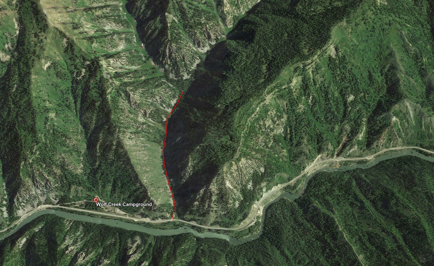
The canyon is rather steep walled, but a number of drainages into the canyon
have trailheads – Red Creek, Wolf Creek, and East Table Creek. The turn offs in
the winter are plowed allowing for year-round access and most importantly they
are outside of the winter range closures.
Directions
In our first venture we tried the Wolf Creek Trail which is located some 16
miles west of Hoback and before the Wolf Creek campground.
February Conditions
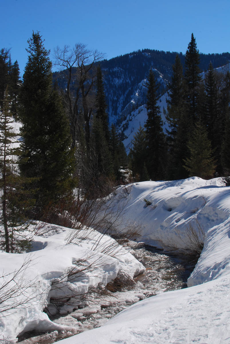
We were unable to complete the trail in February. We got roughly one mile up the
drainage with snow shoes before turning back. This was, in large part, due to
the burn on the west side of the drainage. This leaves the landscape open for
avalanches, of which there were many. A hiker with a more aggressive
“mountaineering” shoe may make the trip, but our wide flat-lands snow shoes were
insufficient.
The avalanches left large piles of breakdown crossing the trail. This required a
great deal of scrambling over five-foot wide bricks of snow not unlike
scrambling over cave breakdown. In other areas the snow bank was simply a steep,
smooth layer of ice that slide down the hill into the river. In these instances
it was difficult to get a sound perch as our snow shoes’s claws were not enough
to keep us from sliding down hill.
The draw is rather pretty, featuring limestone escapements, pine forest, and a
ready supply of water via Wolf Creek. The maps show that it is possible to
ascend Wolf or Red mountain via this route. We shall try it again come spring or
summer once the snow recedes enough to walk upon a flat trail.
Details
- Location: Pinedale, WY
- Length: 6 mi
- Water Access: None
- Usage: Moderate
- Highlights: Spectacular view of the wind river range, Half Moon Lake and
Pinedale
- Safety Concerns: Steep embankments in areas
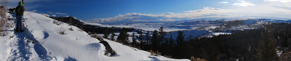
After venturing to Half Moon lake several times throughout February we decided
to check out the cross country ski trails on top of the nearby ridge. We found
these trails to be in much heavier use during the day time than aforementioned
Half Moon, but for what they gave up in solitude we gained in views. Sweeney
Road, an ungroomed cross country tail, is perhaps the most isolating and best
for snow shoeing undisturbed with dogs.
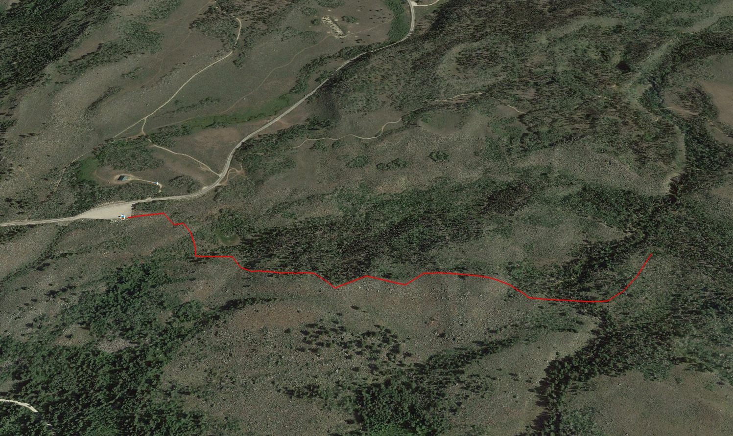
Directions
Like Half Moon, Sweeney Road is accessed via the Fremont Lake road leaving
Pinedale, WY. Proceed some ten miles up the road and passed the turn-off for
Half Moon. The road is plowed up the resort and there are many pull offs for
various groomed cross country skiing trails. The first pull off, however, is for
Sweeney Road which is an ungroomed trail following a Forest Service road.
February Conditions
The groomed cross country ski trails appear to be under heavy use, however being
ungroomed, Sweeney Road sees much more moderate usage. Furthermore, we found
that many snow shoers appear to take the route for only some time before
diverging upon their own paths. In our case we took a branch that looped out
much closer to the ridge edge giving us a wonderful view of Half Moon lake, the
wind river range, and the plains that spread out far below us to Pinedale.
If kept to the main trail the conditions are moderate and fairly easy going upon
snow shoes. The diverging routes however can in places be rather steep and I
imagine unsound if the snow top is icy and hardened. For ourselves the snow was
ideal having a good layer of snow that we easily sunk into giving us a good grip
upon the hillside.
Details
- Location: Pinedale, WY
- Length: 3 mi (Winter)
- Water Access: None (Winter)
- Usage: Light (Winter)
- Highlights: View of Half Moon Lake, Windriver Range
- Safety Concerns: Care should be taken with ice depth. I have found no
official ice-depth reports
The Wind River Range in Pinedale, WY has a number of trails open for snow shoes
or cross country skis year round. In our ventures south of Jackson, we have
found the range rather open although range closures do exist in areas and many a
Forest Service road turns into snowmobile track.
The paved road to Fremont lake, however, remains plowed and open year round
giving easy access for a wintertime hiker.
Directions
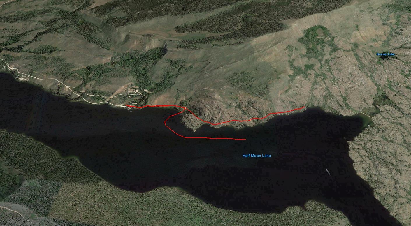
Half Moon Lake lies south of Fremont Lake. Both can be accessed via Fremont Lake
Road, paved route leaving Pinedale and heading north-east. This route is plowed
year-round. Proceed some seven miles along the route until it diverges. A sign
for the Half Moon resort is posted upon this fork. Turn right upon it and
proceed down a gravel road. The fork is plowed, although poorly and I suspect
only by chance of the private residences on the western lake shore. Signage
indicts these private drives and are rather aggressive reading “Trespassers will
be shot.”
Past the private drives is the campground, boat docks, and eventually parking
for the resort. The latter being the furthest one can get in the winter to the
trailhead itself.
February Conditions
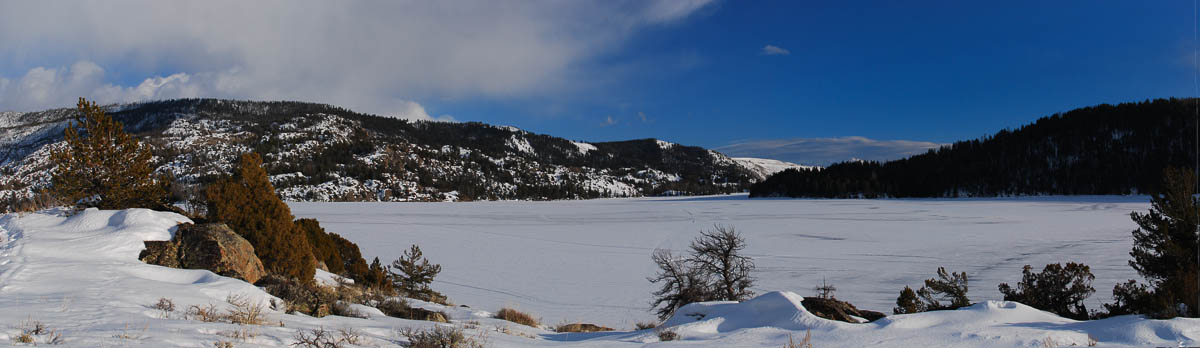
We returned to Half Moon lake several times in February. The lake is frozen, and
although there are snowmobile tracks across it, the many weeks of above freezing
weather gave us ill ease at walking out far from shore. Likewise, the warm
weather left sections of the trail devoid of snow requiring us to remove snow
shoes and embark upon foot only to find the snow returning in depths of four to
five feet a hundred yards further.
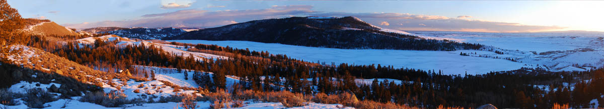
The view is rather beautiful. The frozen lake a smooth expanse rising into a
pine covered hill on the far side. The eastern shore and trail are devoid of
trees giving it a highlands desert feel. The rocky soil covered in sage of
various types and much sign of elk and deer.
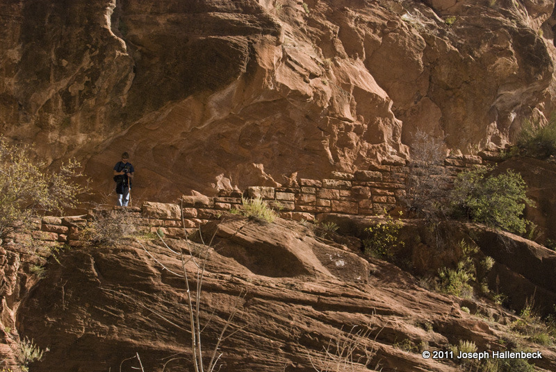
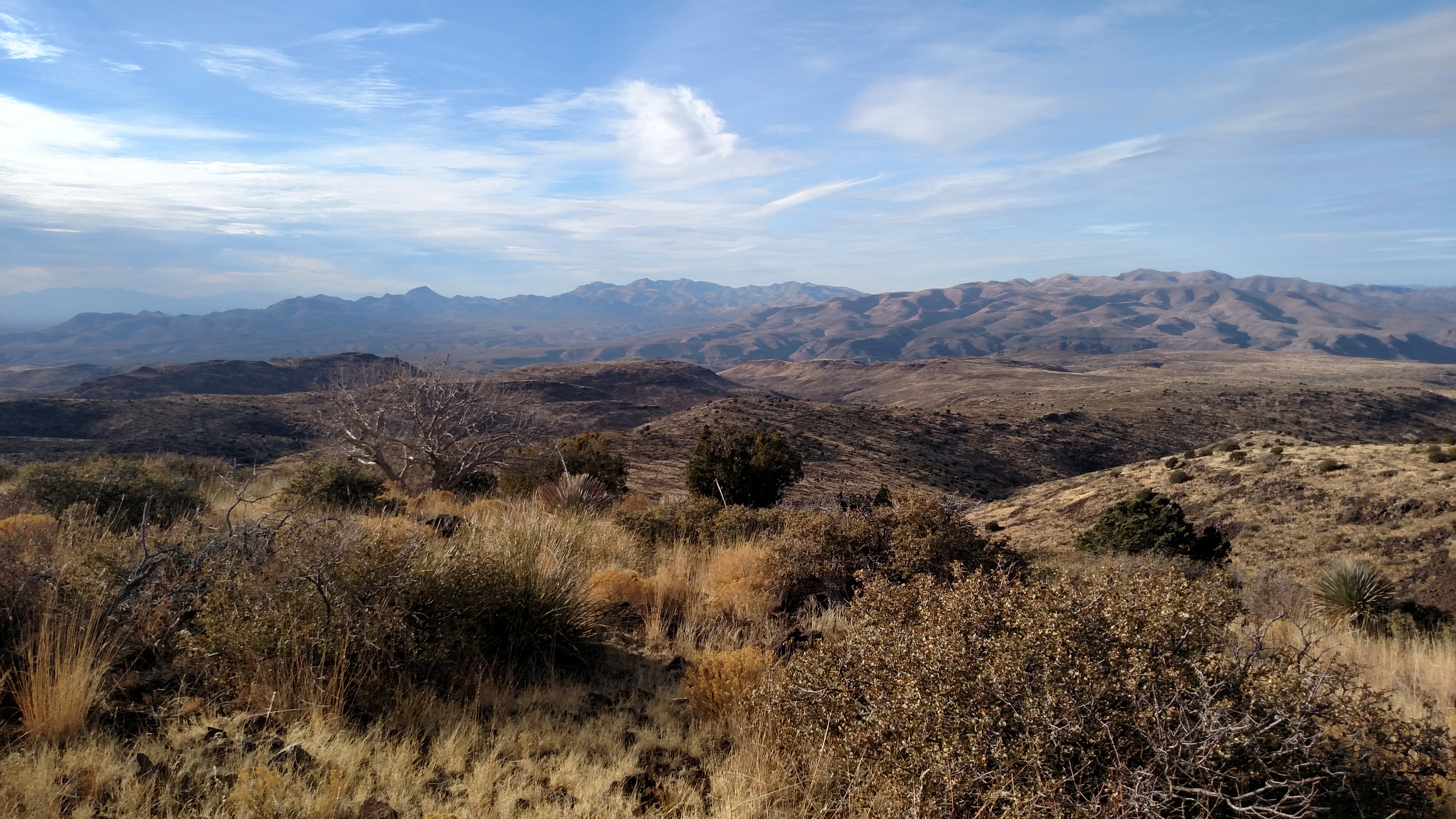
I just returned from a month-long road trip around the southwest. After six
long months at Jewel Cave, a few weeks of camping in the frigid nights of a
desert winter, waking to gusting winds, and traversing three-thousand miles of
the American west, I feel a renewed vigor for returning to work.
I notice that film equipment never fails to break right before a big trip (when
I toured Ireland in 2008 my auto-focus on my telephoto lens broke). This time I
not only broke my tripod immediately before the trip, I discovered that my
flashgun wouldn’t fire on the second day. I lugged the useless flashes around
for the remainder of the trip.
My current plans: I have two short stories I began developing in the southwest
that I want to complete over the next month alongside the final touches on
Sunset Office Cleaning’s website. After
that, a move to Missoula, MT where I hope to find inspiration amongst the
mountains and the people there.